• 1.png
  • 2.png
  • 3.png
  • 4.png
  • 5.jpg
  • 6.JPG
  • 7.JPG
×

Message

Failed loading XML... xmlParseEntityRef: no name xmlParseEntityRef: no name xmlParseEntityRef: no name xmlParseEntityRef: no name xmlParseEntityRef: no name xmlParseEntityRef: no name xmlParseEntityRef: no name Entity 'nbsp' not defined Entity 'nbsp' not defined xmlParseEntityRef: no name xmlParseEntityRef: no name error parsing attribute name attributes construct error Couldn't find end of Start Tag elements.length line 1 EntityRef: expecting ';' EntityRef: expecting ';' xmlParseEntityRef: no name xmlParseEntityRef: no name xmlParseEntityRef: no name xmlParseEntityRef: no name xmlParseEntityRef: no name xmlParseEntityRef: no name xmlParseEntityRef: no name xmlParseEntityRef: no name xmlParseEntityRef: no name xmlParseEntityRef: no name xmlParseEntityRef: no name Opening and ending tag mismatch: header line 1 and div Opening and ending tag mismatch: body line 1 and header Opening and ending tag mismatch: html line 1 and body Extra content at the end of the document

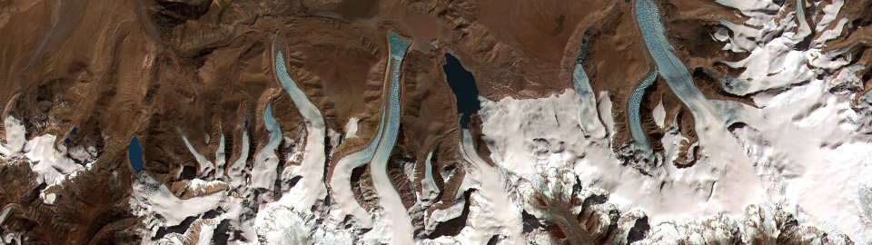
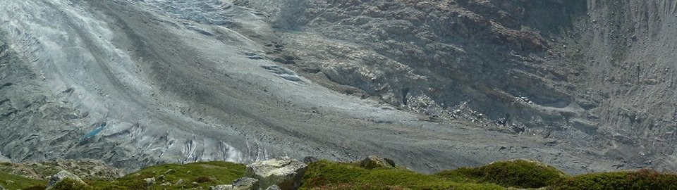
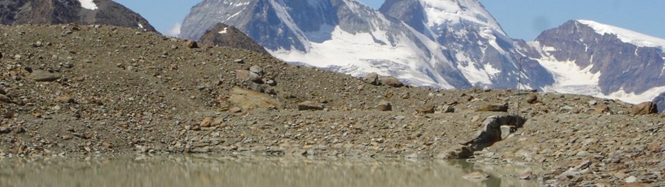
Abstract. Floods resulting from the outbursts of glacial lakes are among the most far-reaching disasters in high mountain regions. Glacial lakes are typically located in remote areas and space-borne remote sensing data are an important source of information about the occurrence and development of such lakes. Here we show that very high resolution satellite Synthetic Aperture Radar (SAR) data can be employed for reliably mapping glacial lakes. Results in the Alps, Pamir and Himalaya using TerraSAR-X and Radarsat-2 data are discussed in comparison to in-situ information, and high-resolution satellite optical and radar imagery. The performance of the satellite SAR data is best during the snow- and ice-free season. In the broader perspective of hazard management, the detection of glacial lakes and the monitoring of their changes from very high-resolution satellite SAR intensity images contributes to the initial assessment of hazards related to glacial lakes, but a more integrated, multi-level approach needs also to include other relevant information such as glacier outlines and outline changes or the identification of unstable slopes above the lake and the surrounding area, information types to which SAR analysis techniques can also contribute.


External Community News:

  • ESA Observing the Earth Nov 3, 2025 | 15:23 pm

    Sentinel-1D and Ariane 6 ready for liftoff The Sentinel-1D satellite is in position on the launch pad at Europe’s spaceport in French Guiana – ready for liftoff on board the Ariane 6[…]

    Read more...
  • ESA Observing the Earth Nov 3, 2025 | 10:45 am

    Sentinel-1 mission… did you know? The Sentinel-1D satellite is ready to launch tomorrow (Tuesday 4 November) and, when it is fully commissioned, it will work with Sentinel-1C to capture high-resolution[…]

    Read more...
  • ESA Observing the Earth Oct 28, 2025 | 09:00 am

    Watch live: Sentinel-1D launch on Ariane 6 The Copernicus Sentinel-1 mission is about to get its fourth satellite, with Sentinel-1D now ready for liftoff. Launch will take place with an Ariane 6[…]

    Read more...